

Two tall masses of brick rise above the lower walls of the royal palace at Polonnaruwa. Entrance steps still give the ruin a direction. Trees frame the building, while the empty spaces make its former height difficult to recover. A palace survives, but much of the architecture that made it a place of government has disappeared.
Elsewhere in the city, stone has endured differently. A Buddha remains seated against a carved rock face. The steps of a circular shrine still pass between guarded entrances. A great slab carries a king's account of his own achievements. These monuments draw the eye, but their histories extend into the land around them: fields, reservoirs, roads, workshops and the communities that kept the city supplied.
Polonnaruwa was one of medieval Sri Lanka's principal centres of power. Its best-known buildings belong to the eleventh and twelfth centuries, although the place had an earlier history and continued to matter after its greatest royal building programmes ended. UNESCO inscribed the ancient city on the World Heritage List in 1982, recognising a landscape that includes Chola Hindu monuments as well as the later Sinhalese royal and Buddhist establishments.
The surviving places offer several ways into that history. Read together, they reveal a city repeatedly inherited, altered and claimed.

The surviving brick walls and entrance steps of the royal palace.
A capital with more than one beginning.
Polonnaruwa did not emerge from an empty landscape when a famous king decided to build. It had already served royal and strategic purposes before becoming a major capital. Its rise was connected to changes at Anuradhapura, the much older centre of kingship to the north-west.
Chola forces under Rajaraja I advanced into northern Sri Lanka in 993. A later conquest under Rajendra I, associated with 1017, brought the capture of Mahinda V and a further extension of Chola power. Those events are sometimes compressed into a single date, obscuring the stages of the conquest. In his edition of the Culavamsa, Wilhelm Geiger connects the later event to Rajendra's inscriptions, rather than deriving its date from the chronicle alone.
Polonnaruwa became an important Chola administrative centre. The Hindu shrines and sculptural traditions associated with this period are part of the city's history, not an incidental interruption in it. South Indian connections continued under later rulers through war, service, religion and the movement of people.
Vijayabahu I recovered Polonnaruwa around 1070 and retained the city as a centre of royal power. He supported Buddhist institutions and the restoration of religious life after prolonged conflict. The Atadage, associated with the Tooth Relic, belongs to this phase. Parakramabahu I, who ruled from 1153 to 1186, inherited a city with those earlier layers already present.
What the palace can show.
The palace ruins are closely associated with Parakramabahu I's transformation of Polonnaruwa. The Culavamsa describes his court buildings in terms of splendour and royal achievement. Its account helps establish the place of construction within his kingship, but it is a celebratory text, not a surviving architect's survey. The exact appearance of a complete palace cannot simply be read back from the broken brickwork.
The surviving fabric nevertheless makes some things tangible. Thick walls, openings and changes of level show that this was a substantial building, organised vertically as well as across the ground. The loss of upper structures is part of the difficulty of interpreting it. A modern photograph records the ruin and its present setting, not the building as a medieval court would have known it.
Nearby, the raised platform commonly identified as Parakramabahu's council chamber offers a different kind of survival. Its carved courses, steps and rows of columns preserve the treatment of an important formal space. Elephants move along the relief at its base; lions mark the approach. The building's arrangement would have shaped the way people entered and occupied it, even though a photograph cannot recover the precise business conducted on a particular day.
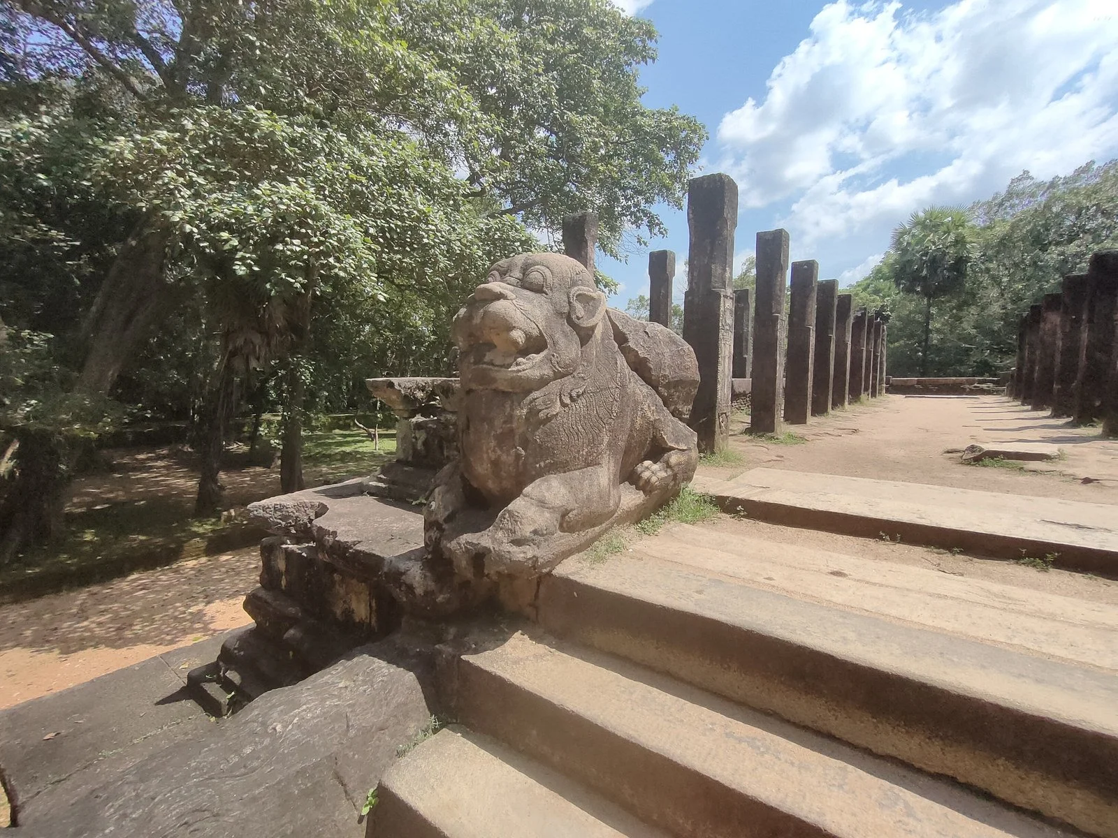
A lion at the council chamber entrance, with columns behind.
Royal architecture required more than a commission. Brickmakers, quarry workers, carvers, carriers and builders converted resources into a place of authority. Their individual names are largely absent from the surviving royal narrative. Their work remains in the material itself.
Water beyond the royal name.
The city's monumental buildings belonged to a landscape sustained by managed water. In the dry zone, storing and distributing water helped make cultivation possible across changing seasons. Reservoirs and channels were also long-term commitments. An embankment had to remain sound; an outlet had to function; water had to reach the land for which it was intended.
Parakrama Samudra is closely associated with Parakramabahu I, but the history of the reservoir includes earlier water bodies and later rebuilding. The International Commission on Irrigation and Drainage records significant twentieth-century rehabilitation and changes to the connected system. Its present outline should therefore not be treated as a perfectly preserved map of the twelfth century.
A famous passage in the Culavamsa gives Parakramabahu the determination that rainwater should be put to use before reaching the sea. The context matters. The passage occurs in the account of his earlier regional government, before the narrative of his rule over the whole island. It is not a verified transcript of a speech delivered beside the reservoir now visited at Polonnaruwa.
The broader point remains important. Water management was central to the political ideal expressed by the chronicle. Yet a ruler's ambition alone could not maintain a working landscape. The continuing labour of clearing, repairing, regulating and cultivating made the system useful.
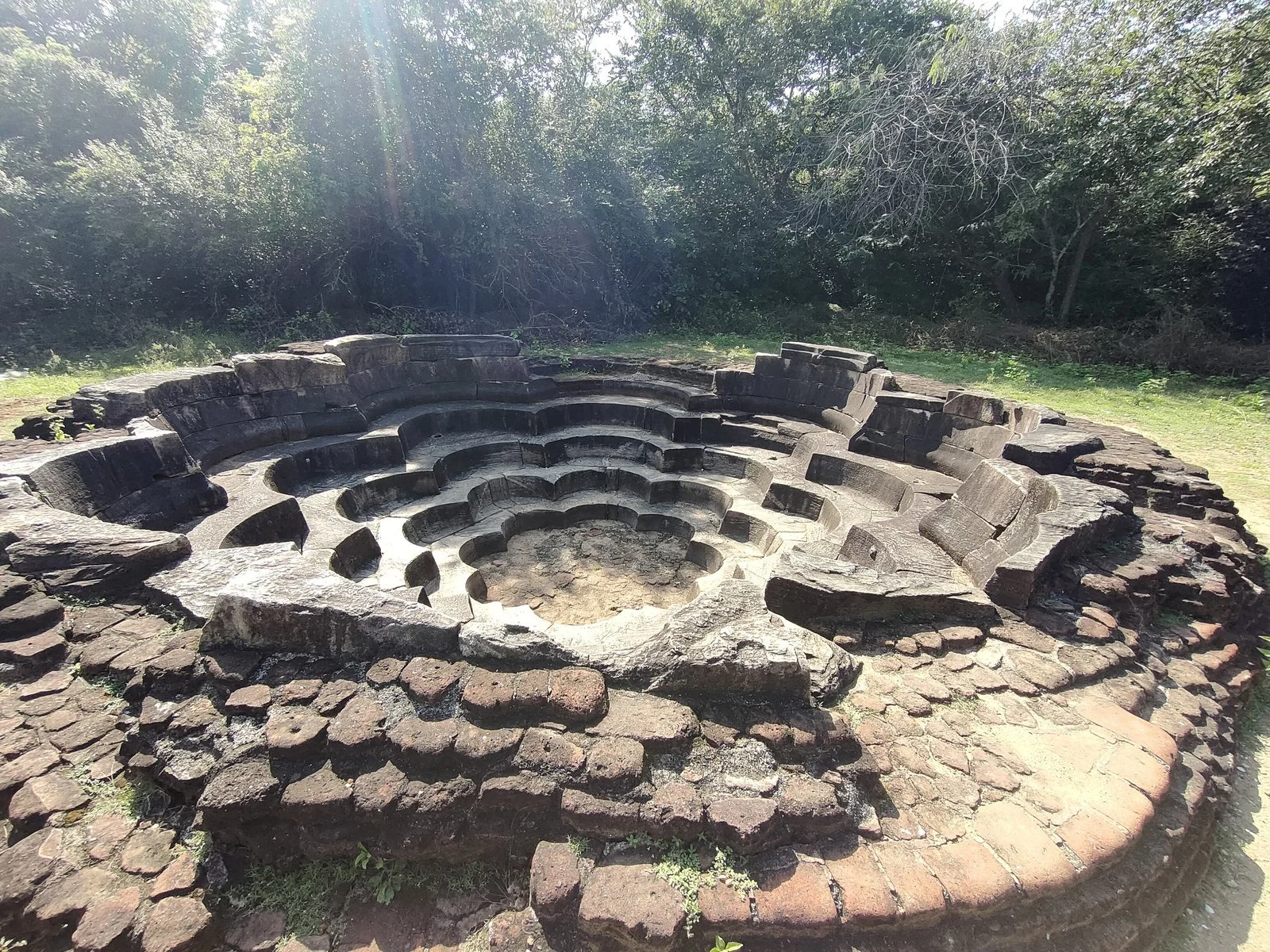
The curved stone levels of the Lotus Pond.
Within the monastic landscape, smaller water structures bring that relationship down to another scale. The Lotus Pond gives stone a sequence of curved, descending levels. Its form is immediately striking. Alongside larger reservoirs and channels, such ponds show the variety of ways water was contained and given an architectural setting within the city. Their scale and purpose should not be confused with the irrigation works beyond the monuments.
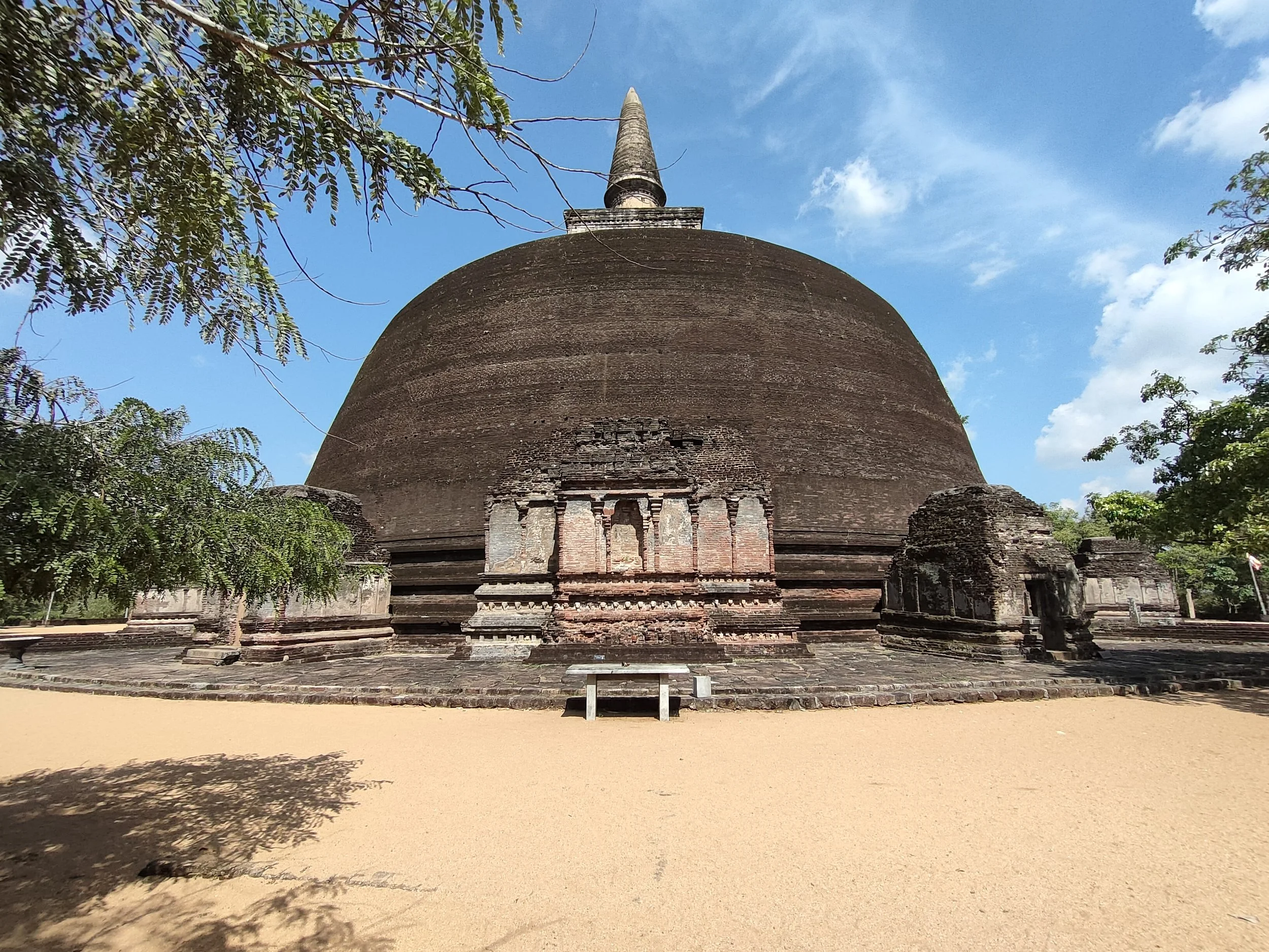
The brick dome and spire of Rankoth Vehera rise above the smaller shrines at its base.
The sacred centre and its guardians.
The group of monuments often called the Sacred Quadrangle, or Dalada Maluwa, concentrates several generations of religious building. Names such as Atadage and Hatadage should not be treated as interchangeable. They belong to different foundations and royal associations within the history of the Tooth Relic.
The circular Vatadage is one of the most recognisable structures in the group. Its stepped approach, carved entrance stones and seated Buddha images remain unusually legible. The building's precise history is less straightforward than a single caption naming its builder might suggest. Both the chronicle's building descriptions and Nissanka Malla's claims have informed its attribution. A careful account allows for that history of interpretation rather than offering an unsupported certainty.
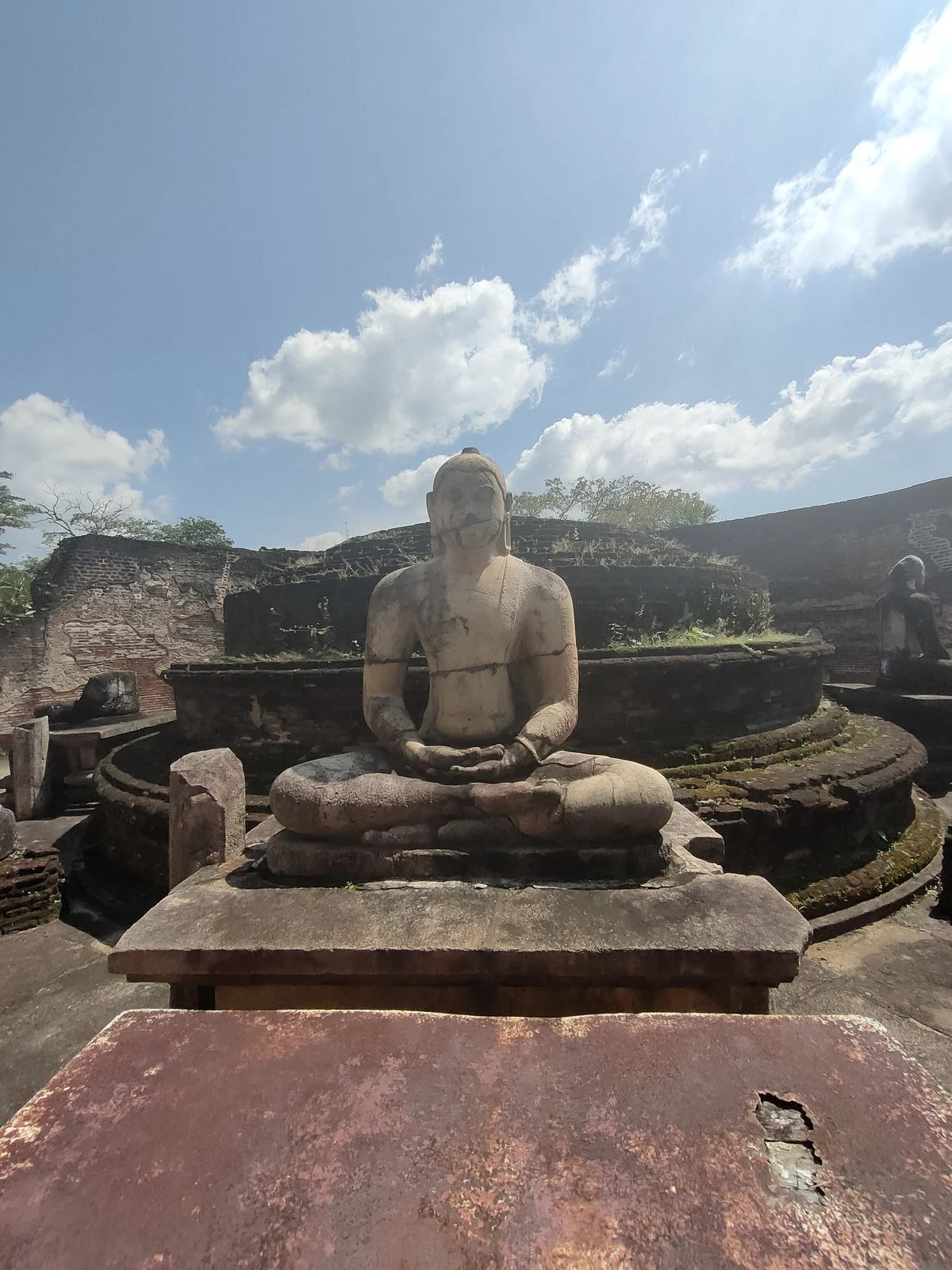
A seated Buddha at the Vatadage, within the Sacred Quadrangle.
Another record in the Quadrangle changes the way the whole place can be understood. The Velaikkara inscription, written mainly in Tamil with a Sanskrit opening, records a military community's undertaking to protect the Tooth Relic temple. The record is not itself dated; its chronology has been reconstructed through historical and palaeographic study. The undertaking extends beyond the relics themselves. It includes the temple's villages, retainers and property, and people who entered it for refuge. A soldier from each regiment was to be assigned to its protection, supported by land.
Its significance is clear without forcing an exact year. The protection of a Buddhist sacred institution involved people whose connections did not fit a simple division between a Sinhalese Buddhist island and a Tamil Hindu world across the water. Language, service and political loyalty could intersect in more complicated ways. The inscription gives those relationships a material presence within the city.
Gal Vihara and the life of the monastery.
At Gal Vihara, the granite itself became the setting for large rock-cut figures. The seated Buddhas and the long reclining image are among Polonnaruwa's most familiar works of sculpture. Their survival can make the encounter feel immediate, but the modern protective roof and the exposed remains belong to a site with a long history of change.
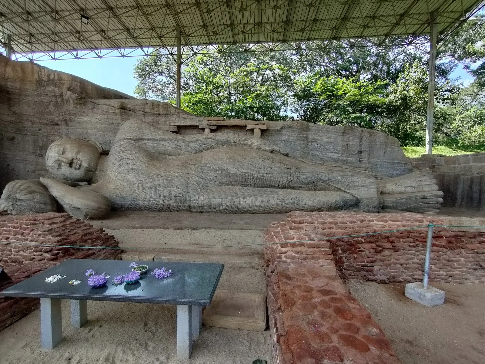
The reclining Buddha at Gal Vihara, beneath the modern protective shelter.
The sculptures formed part of the Uttararama, associated with Parakramabahu I. An inscription beside the central cave shrine sets out a code of conduct for Buddhist monks. It has a historical introduction followed by disciplinary rules. The code describes a day shaped by meditation, study, care of sacred places and duties towards other monks. Rules controlling journeys to villages allow exceptions for supporting dependent parents and certain relatives, and for obtaining medicine for the sick.
That record brings another aspect of the monastery into view. These were organised communities with routines, responsibilities and standards of conduct. The great images stood within a religious establishment sustained through teaching, worship, material support and regulation. To describe Gal Vihara only as a group of beautiful statues would leave much of its historical purpose unexplained.
The relationship between royal power and the Buddhist order was therefore more substantial than the making of gifts. Patronage could accompany attempts to define discipline and strengthen institutional authority. The inscription and the sculptures answer different questions about the same place.
A king writes his own record.
Nissanka Malla, who ruled from 1187 to 1196, left inscriptions across Polonnaruwa. The Gal Pota, or Stone Book, is the most imposing example. Its long surface is covered with writing, while carved decoration gives the sides and ends a form beyond that of a plain record.
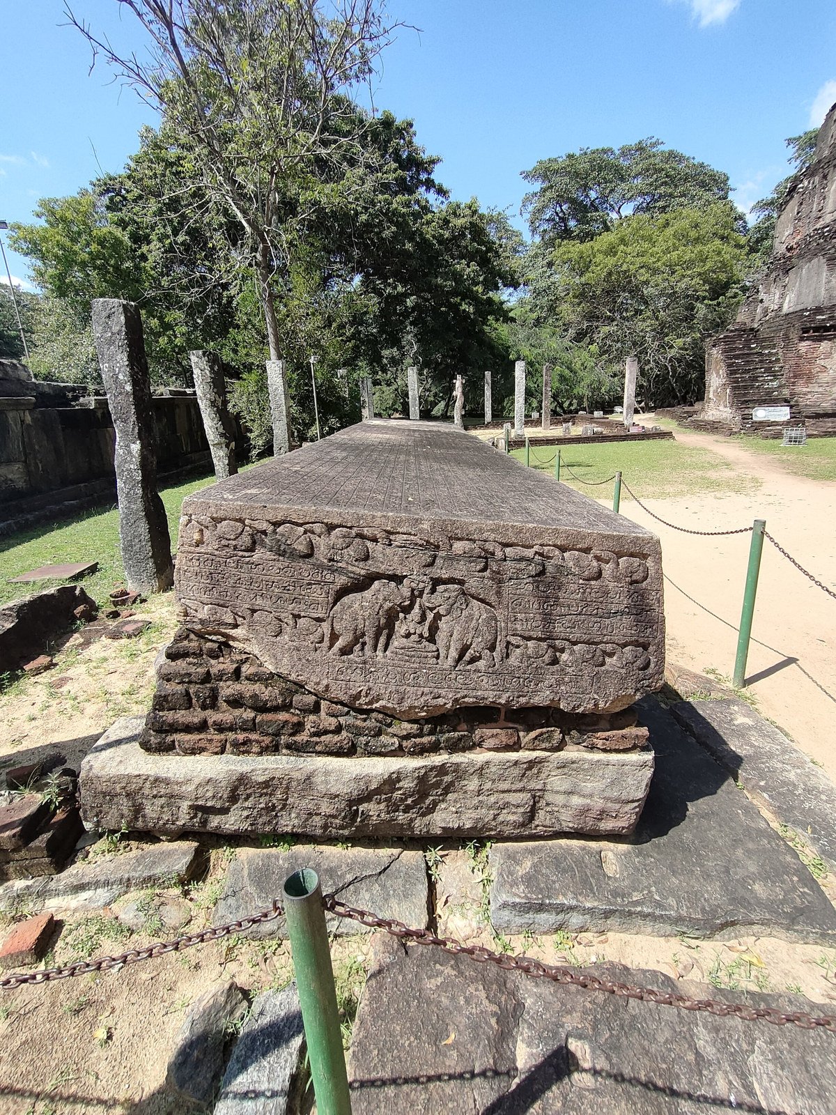
Carved decoration at the end of the Gal Pota, the Stone Book associated with Nissanka Malla.
The text presents the king as a legitimate and generous ruler. It describes donations, public works and his understanding of who was entitled to rule. Such statements are valuable evidence, but they are not neutral assessments supplied by an independent observer. They show how a monarch wanted his authority to be understood.
The distinction does not make the inscription unimportant. It makes it more revealing. The scale of the stone, the effort of inscribing it and the content of the message all belong to the work of kingship. The ruler's voice survives unusually clearly, while many people who quarried, moved and carved the material remain unnamed.
A city that changed after its great kings.
Polonnaruwa's later history cannot be reduced to one empty city left behind after a single invasion. Political struggles, warfare and the movement of royal centres changed its position. The chronicle gives a hostile account of Magha's rule, and its description needs to be read as testimony from a particular religious and political perspective.
The same historical tradition also records later restoration at Polonnaruwa and the return of ceremonies and relics. These passages do not prove that the city regained its earlier scale. They do show that it continued to possess religious and political significance after the period most visitors associate with its monuments.
The ruins seen today add further layers: excavation, conservation, reconstructed features, protective shelters and the needs of a place still visited for religious as well as historical reasons. Those interventions should remain visible in the story.
Echoes & Edges Reflection.
Polonnaruwa rewards attention to the connections between its places. A palace leads towards the labour and resources of government. A reservoir leads towards cultivated land and maintenance. A shrine leads towards patronage, communities and the movement of sacred objects. An inscription gives a ruler a voice, while also showing how much of the city's work lies beyond what he chose to record.
The photographs preserve particular views. The history begins to widen when those views are read together.
